

Lidar Scanning Columbia SC
LiDar Scanning Columbia, SC
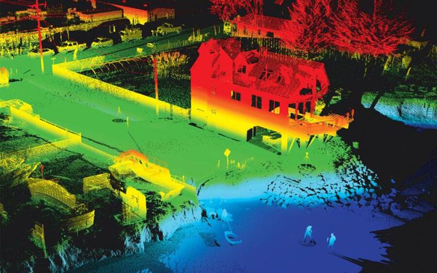
LiDAR (Light Detection and Ranging) scanning in Columbia, SC is a cutting-edge technology that utilizes laser pulses to capture precise spatial data, enabling the creation of detailed and accurate 3D models of objects, landscapes, and environments. In Columbia, South Carolina, LiDAR scanning has become an invaluable tool across various industries, offering unparalleled precision and efficiency.
How LiDAR Scanning Works
LiDAR systems emit laser pulses that travel to a target and reflect back to the sensor. By measuring the time it takes for each pulse to return, the system calculates the distance between the sensor and the target. This process is repeated millions of times per second, resulting in a dense collection of data points known as a “point cloud.” These point clouds are then processed to generate highly accurate 3D representations of the scanned area or object.
Applications of LiDAR Scanning in Columbia, SC
The versatility of LiDAR scanning makes it applicable in numerous fields:
- Architecture and Construction: LiDAR provides precise measurements for creating as-built drawings, facilitating renovations, and ensuring structural integrity. Local firms, such as MG3D, LLC, utilize LiDAR for virtual design and construction services.
- Environmental Monitoring: LiDAR aids in mapping terrains, assessing vegetation, and monitoring changes in landscapes, which is crucial for environmental planning and conservation efforts. The South Carolina Department of Natural Resources offers LiDAR data for such applications.
- Historical Preservation: Accurate 3D models of historical sites can be created to aid in preservation and restoration projects, ensuring that detailed records are maintained for future generations.
Advantages of LiDAR Scanning
- High Accuracy: LiDAR delivers precise measurements, capturing fine details that traditional surveying methods might miss.
- Efficiency: The rapid collection of data reduces the time required for surveys, leading to quicker project turnarounds.
- Versatility: LiDAR is effective in various environments, including areas with dense vegetation or challenging terrains.
LiDAR Scanning Services in Columbia, SC
Several companies in Columbia offer professional LiDAR scanning services:
- GPRS 3D Laser Scanning: Specializes in delivering accurate as-builts, point clouds, 2D CAD drawings, and 3D BIM models to expedite project planning and reduce costs. Utility Locating & Inspection
- Carolina Metrology: Provides 3D laser scanning and dimensional analysis services, utilizing advanced equipment for precise measurements. Carolina Metrology
Innovations in LiDAR Technology
The advancement of LiDAR technology has led to the development of user-friendly applications for mobile devices. For instance, Polycam allows users to capture high-quality 3D models using their smartphones, making LiDAR more accessible for various applications.
Conclusion
LiDAR scanning stands at the forefront of technological innovation in Columbia, SC, offering precise and efficient solutions across multiple industries. Its ability to produce detailed 3D models enhances project accuracy, reduces costs, and opens new possibilities for analysis and visualization.
For more information on how LiDAR scanning can benefit your projects, explore the services offered by local providers and consider integrating this technology into your workflows.